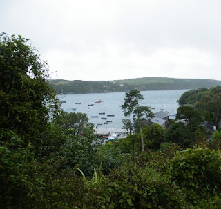
First chance we have had to get away this autumn and it seems our usual haunt at this time of year is Glenariff. Weather on Friday was appalling but by morning had cleared for a wonderous dawn; temperature was decidedly chilly but the air was crystal clear and the silence in our part of the forest was enormous. This was definitely a day to get out and enjoy the world.
On wer bikes and down the lane to the main road. Coming up here last night, in the dark, the road felt treacherous, slipping and sliding. In daylight the reason was clear - a carpet of red pine needles covered the road and given yesterday's rain it not only looked like a single item rather than hundreds of parts but felt and behaved like a greased plastic sheet.There was an odd stillness about the place too; barely a breath of air moved the trees and the few deciduous ones stood starkly naked against the winter blue sky.
On the other side of the main road, the public forest park road was well littered too. The entrance road skirts the top of the deep gulley where the main river of the glen flows. As the valley deepens a couple of impressive waterfalls appear as the river cuts its way through the valley floor. Unusually today we can see right down to the flowing water from the road above. Either there are more deciduous trees than I imagined here or there has been some wide-spread tree felling in progress.
Arriving in the car park we leave the bikes to walk down to the waterfalls and on to Laragh Lodge for a morning coffee. We don't get far - the path is blocked by tape and wooden barriers with large warning signs.Evidently tree felling is in progress then and that's why the valley looked so bare. One of the signs has lots of multi-coloured text and the story it tells is not good. Giving up on that path we head for the reverse route.
Passing the viewpoint looking down the valley toward Waterfoot and the sea. The quality of light is typical for a chilly November day; bright sunshine catching the shadows along the higher edges of the great U-shaped valley. The exhibition centre describes the ancient sharing of the farmland and its easy to imagine long narrow family plots rising up from the valley floor to the grasslands at the top likely still holding treasures of buried hoards of butter from summer grazing. Nowadays many of these fields have merged into single farms or tracts of forest and its easy to see the pockets of larch brown against the evergreen of the other conifers. This might be the last time we see these woods in our life-time.
The reason for blocked paths and extensive tree felling becomes clear as we walk further on and are blocked again. There is no access to the forest. A stack of red, freshly harvested timber - the result of devastation of the nearby hill-side. A sign proclaims "Phytophthora Ramorum".
In one of those odd - and it seems all too frequent - coincidences, a Radio 4 program a couple of days before, possibly "Gardener's Question Time", had described the disaster that was affecting much or rural Cornwall with vast tracts of mature woodland being chopped down; forcibly (by law) left fallow for up to seven years before replanting could begin again. All because an insidious pathogen infecting most of the Larch trees in the area. It seems, the disease had taken a turn for the worse in 2009 and had mutated into a very virulent and infectious form that was rapidly spreading throughout the country wrecking havoc wherever Japanese larch were growing. It was also jumping species and attacking other trees and shrubs as it went, taking out Rhododendrons and decimating some of the long established formal gardens.
It had been known in Northern Ireland since 2009 but evidently a major incident had occurred here with the result that many, if not all, larch trees in the forest had been taken down after evidence of the disease had been found. According to an official report in August (http://www.forestry.gov.uk/pramorum), infections have been found in Sitka Spruce in Irish forests - this is the most widely planted tree species in the British Isles. Things do not look good; all the conifer forests may be under threat and if they have to be removed, it will take 30 or 40 years for forests to recover to their current population. We will be long gone.
On Sunday, we headed in the other direction intending to perhaps wander down the stream nearby that fed the main river in the larger park across the road. As we moved out of the shelter of the evergreens in the camp site, this part of the forest had been devastated too. Vast swathes of larch trees had been removed leaving barren fields of stumps, broken branches and piles of sawdust. On this scale, it was depressing to see and we just retreated back to the fantasy world of audio-book storytelling. On a better day a discourse on Caravaggio might have been in order to echo the subject of the storybook but for now it will have to wait.
Saturday, 5 November 2011
Tuesday, 12 July 2011
Ross Castle, Killarney
For our final day, the sun came out, deliciously warm.
We managed to arrive at Ross's Castle before the crowds got there, before the boatmen were even up and about. The castle is seriously impressive with several unusual features like the two points near the top for pouring oil down on attackers: one in stone on the right, and the other covered by a wooden flap near the centre.
The castle and its walls were fairly typical of a Irish chieftain's stronghold in the 15th century. It was much extended and enhanced over the centuries.
The castle sits on the edge of one of the famous lakes of Killarney. The day was wonderfully clear as we cycled through the grounds. Flocks of swans preening themselves in tranquil spots. We had to give way to the stream of horse and traps filled with tourists tripping out from Killarney town to the Castle.
After returning to the castle we head in the other direction to investigate the various monuments, structures and remains of a series of copper mine workings. It was quieter on this side with fewer tourists, no traps and hardly a boat to break the mirror still lake.
We managed to arrive at Ross's Castle before the crowds got there, before the boatmen were even up and about. The castle is seriously impressive with several unusual features like the two points near the top for pouring oil down on attackers: one in stone on the right, and the other covered by a wooden flap near the centre.
The castle and its walls were fairly typical of a Irish chieftain's stronghold in the 15th century. It was much extended and enhanced over the centuries.
Ross Castle |
The castle sits on the edge of one of the famous lakes of Killarney. The day was wonderfully clear as we cycled through the grounds. Flocks of swans preening themselves in tranquil spots. We had to give way to the stream of horse and traps filled with tourists tripping out from Killarney town to the Castle.
Killarney Lakes |
After returning to the castle we head in the other direction to investigate the various monuments, structures and remains of a series of copper mine workings. It was quieter on this side with fewer tourists, no traps and hardly a boat to break the mirror still lake.
Monday, 11 July 2011
Beara Peninsula
We were on a whistle-stop drive now
Approaching the end of the peninsula found a wonderful little inlet at Billeragh. The sea was incredibly clear and a wonderful shade of green. Above the cove there was a perfect camping spot, designed for a couple of campervans but by now we were on our bikes.
We headed for the end of the peninsula and Dursey Island and surprisingly found the only cable car in Ireland. It was mobbed with sight-seers and quite a queue waiting for the cable car. The car looked like an old Fiat 500 that had seen better days; the island did not appeal so we passed on the trip.
By the time we returned to the van, the day had warmed up and the beaches near Billeragh had filled up with surfers and water boarders. It was something of a squeeze to get the van past the parked cars. We were on the road again, along the north coast of the Beara Peninsula. The most magical view of the whole trip was just around the corner: the sun lit up the beach at Ahillies and with the backdrop of the mountains, it looked spectacular (the photo doesn't even come close to how good it looked). We didn't expect to actually reach it and despite its colourful buildings, it didn't quite live up to expectations
Continuing along the coast, the views over to the Ring of Kerry were awesome and after Allihies we hardly passed any settlement of any consequence till we approached Kenmare. But we did not pause, the weather was closing in and headed for Moll's Gap
The descent from Moll's Gap through Killarney National Park cannot fail to impress. We stopped at our usual view points and although nothing has changed since the last time we were here, it was just like seeing it all for the first time again.
Be did track down the causeway that looked ready to collapse and despite a few running repairs still sagged reluctantly under the weight of traffic.
Approaching the end of the peninsula found a wonderful little inlet at Billeragh. The sea was incredibly clear and a wonderful shade of green. Above the cove there was a perfect camping spot, designed for a couple of campervans but by now we were on our bikes.
Billeragh and the Ring of Kerry |
Ballaghboy Cable Car |
Allihies |
Salmon Fishery on approach to Kenmare |
Causeway at Killarney National Park |
Sunday, 10 July 2011
Healy's Gap
Healy's Gap: south and Cork |
At the gap itself there was a bit of a stopping place with a monument to those who built the road. The gap marks the boundary between Cork and Kerry. Looking south to Cork there is little to see - just rock strewn moorland with a meandering road.
Healy's Gap: north and Kerry |
We had hoped to do a sort of figure-of-eight route to take us through the gap looping back to Castletownbere. It didn't quite workout that way but we did reach the town. Had an ice cream and moved on; it was getting hard to interest us by now. We eventually stopped at Berhaven Gold Club which had hard-standing for vans. Didn't look at all promising but turned out really well
Moon rise over Bear Island |
Saturday, 9 July 2011
Sheepshead
View towards Carrigacat |
This was an unpopulated peninsula with only occasional farmsteads to pass by. Eventually the road narrowed to such an extent, is was difficult to navigate. We found a parking place and got out the bikes.
Sheepshead Lighthouse |
After 10Km or so of switch-back lanes winding through bracken, heather, gorse and limestone, even the road gave out. Fortunately at a little coffee shop to gird our loins as we set out on foot for the 3Km clamber to Sheepshead lighthouse right at the very end of the finger of land pointing into the Atlantic. The lighthouse is perched high on cliffs dropping dramatically to the coast-line remaining hidden below.
View from the light North to Beara |
Even the walk back gave some terrific views of sheer drops to the sea and the odd house or cottage nestled out of the wind; there were no trees at all out here.
Dusk at Glangariff |
It was getting late now by the time we returned to the van so there was little time to savour as we headed for Bantry passing through to Glengariff. Looking down the lough gave a lot of promise for tomorrow
Friday, 8 July 2011
Crookhaven
Lough-side looking toward Lackenacea |
The next day the sun rose into a clear blue sky with the odd bits of fluff blowing by. And we discovered we were at the end of the world - as far as Ireland is concerned; the site was on a little isthmus - the Atlantic to one side and a crystal clear lough on the other.
After breakfast we parked at another sandy beach by Ballynaul and got the canoe out to enjoy the Atlantic. As we splashed our way about a pair of grey seals came to see what all the noise was about. The male was enormous, as big as the canoe - just as well he didn't take a dislike to us but neither came close enough. As we got back to shore a cafuffle broke out amongst some nearby tourists; a pod of about 10 common dolphins were cavorting in the lough on the other side of the road. Wow, it couldn't get much better than this.
Crookhaven: out to sea |
Once we had calmed down, on our bikes to visit Crookhaven, the village further up the lough. Pauline fell in love with this place; a couple of house over looking a little harbour with a light on the opposite headland. Today the harbour was full of youngsters learning to sail. Where they all came from is beyond me, there was very little accommodation about even for summer visitors.
Sheepshead from Dunbeacon |
Thursday, 7 July 2011
South West Cork
The landscape has changed now, we were finally in Cork. And so has the weather - rain has arrived, not the pelting sort, more the soft sort you don't notice till you realise you are drenched. We paused at Clonakilty marvelling at the brightly coloured store fronts and very pleasant coffee shops with yummy shop; just the ticket for a chilly, damp day.
Then a slight detour to Castletownsend sometimes fingerposted as Castletownshend. No particular reason to go there we just did. More or less a long, narrow street running downhill to the sea. At the foot, a classy hotel, a small quay of sorts and on a nearby hill, the local C of I church. If there was a shop, we missed it though a couple of ex-shops were evident.
The church hill sat well above the shoreline and gave fine views over the inlet.
The quay itself was just an small open flat area, with stores or walls on two sides of the entrance path and the rest the sea. The van was just about able to turn around to escape - reversing out was not an option.
Although the church was not very big and obviously not servicing a large congregation, the locals made up for lack of numbers by the quality of their breeding - at least so the gravestones suggested. Almost everyone had a title of some description either as peers or high ranking military officers, mostly naval. Grave stones were surprisingly original and not at all traditional except for a rather fine Celtic cross. Though given the blood-lines hardly a traditional cross.
It was still raining when we reached Skibbereen, a great excuse to visit the Famine museum. Despite its small size and lack of exhibits, packed a pretty good punch - well worth a visit.
On the road again to Baltimore. For some reason I expected it to be more a town rather than the tiny fishing village it turned out to be. Or rather, it had been a fishing village, now it seemed filled with holiday-homers milling around trying to learn to sale. Had a yummy lunch though below this impressive tower house.
By now the weather was really starting to close in and visibility poor. We stuttered at Skull for some reason, a rather intense road experience with traffic everywhere going nowhere and not enough road. Phew!
Then a slight detour to Castletownsend sometimes fingerposted as Castletownshend. No particular reason to go there we just did. More or less a long, narrow street running downhill to the sea. At the foot, a classy hotel, a small quay of sorts and on a nearby hill, the local C of I church. If there was a shop, we missed it though a couple of ex-shops were evident.
The church hill sat well above the shoreline and gave fine views over the inlet.
View from Castletownsend Church |
The quay itself was just an small open flat area, with stores or walls on two sides of the entrance path and the rest the sea. The van was just about able to turn around to escape - reversing out was not an option.
Cross in Castletownsend Church yard |
Although the church was not very big and obviously not servicing a large congregation, the locals made up for lack of numbers by the quality of their breeding - at least so the gravestones suggested. Almost everyone had a title of some description either as peers or high ranking military officers, mostly naval. Grave stones were surprisingly original and not at all traditional except for a rather fine Celtic cross. Though given the blood-lines hardly a traditional cross.
It was still raining when we reached Skibbereen, a great excuse to visit the Famine museum. Despite its small size and lack of exhibits, packed a pretty good punch - well worth a visit.
On the road again to Baltimore. For some reason I expected it to be more a town rather than the tiny fishing village it turned out to be. Or rather, it had been a fishing village, now it seemed filled with holiday-homers milling around trying to learn to sale. Had a yummy lunch though below this impressive tower house.
Baltimore Tower House |
By now the weather was really starting to close in and visibility poor. We stuttered at Skull for some reason, a rather intense road experience with traffic everywhere going nowhere and not enough road. Phew!
Wednesday, 6 July 2011
Inchydowney
We could not find anywhere to camp around Kinsale so decided to wild camp above the beach at Inchdowney. We arrived there just as the sun was going down with a spectacular sunset. Popped in for a beer or too in the hotel at the top of the hill.
In the morning, the local surfing school got their boards out and a crowd of youngsters descended to the beach to enjoy the waves. Pauline even had a go on her water-board; not sure whether that counts as surfing - porbably not.
Inchdowney Beach |
In the morning, the local surfing school got their boards out and a crowd of youngsters descended to the beach to enjoy the waves. Pauline even had a go on her water-board; not sure whether that counts as surfing - porbably not.
Tuesday, 5 July 2011
Kinsale
Kinsale has a tempestuous history and the twin forts of Charles and James guarding the entrance to the harbour emphasise this. Nowadays it is a popular up-market holiday retreat. The secluded bay offering plenty of opportunities for water-sports.
I suspect the town lost its status as a major port long ago to neighbouring towns and became a preferred destination of housing developers and second-home owners. The two forts are worth visiting. James Fort on its own island is the smaller of the two and mostly derelict now; quite difficult to find as well.
Charles Fort on the other hand is enormous. We arrived too late to gain admission but just walking around the fortifications gave us an inkling of the scale of the structure. The walls in the picture dwarf Pauline. This bank runs down from the entrance to the shoreline; sheer walls dominate the waterside. Despite their size, neither were ever tested in earnest.
Overlooking Kinsale |
I suspect the town lost its status as a major port long ago to neighbouring towns and became a preferred destination of housing developers and second-home owners. The two forts are worth visiting. James Fort on its own island is the smaller of the two and mostly derelict now; quite difficult to find as well.
Charles Fort |
Charles Fort on the other hand is enormous. We arrived too late to gain admission but just walking around the fortifications gave us an inkling of the scale of the structure. The walls in the picture dwarf Pauline. This bank runs down from the entrance to the shoreline; sheer walls dominate the waterside. Despite their size, neither were ever tested in earnest.
Monday, 4 July 2011
Cobh and Cork Harbour
As we approached Cork, we took a diversion through Cobh or Queenstown as it was known in the days of the Titanic (Kingstown was beside Dublin, now known as Dun Laoghaire). Cork is built on the River Lee and as Ireland's second city, the harbour was extended into the estuary centred on Cobh built on the Great Island.
Even in Norman times it seems, the island had significance and a rather grand Norman Tower House guards the causeway from the mainland. Although derelict, this tower is awaiting planning permission for renovation as a regular dwelling. Quite an impressive address if it works out.
Cobh retains a Victorian elegance from its glory days when ships en route to America would pause here to collect Irish emigrants. There is a museum by the railway station which served as the focus for many Irish people travelling by train to join the ships docked outside. This was the last landfall made by the Titanic on its ill-fated first and only voyage.
Cobh itself is built on steep hillside dropping down to the sea. Roads twist and turn trying to compensate for the landscape and a plethora of road signs point in every direction imaginable. This makes for spectacular views from the buildings looking out over Cork Harbour but equally looking back at the Victorian grandeur - often passed its best like the temple converted to a pub and now languishing boarded up and unused. The grey granite cathedral still looks magnificent though.
Across the water are the wonderfully named Haulbowline Island and Spike Island. Haulbowline has been fortified since the 16th century originally by the British Army but later the Navy took over the island as a dockyard, arsenal and naval base during the Napoleonic Wars. The world's first yacht club was established here in 1720!
We never made much of Cork: our passenger window had jammed open and we searched the city for a Fiat dealer who asked us to come back in the morning. We headed out to Blarney on our first rainy day - obviously with our window stuck open. Just about had time to spot Blarney Castle before zooming in to Cork for running repairs then onto Kinsale.
Belvelly Tower House |
Even in Norman times it seems, the island had significance and a rather grand Norman Tower House guards the causeway from the mainland. Although derelict, this tower is awaiting planning permission for renovation as a regular dwelling. Quite an impressive address if it works out.
Sculpture on Cobh Promenade |
Cobh retains a Victorian elegance from its glory days when ships en route to America would pause here to collect Irish emigrants. There is a museum by the railway station which served as the focus for many Irish people travelling by train to join the ships docked outside. This was the last landfall made by the Titanic on its ill-fated first and only voyage.
Vacant Cobh Pub |
Cobh itself is built on steep hillside dropping down to the sea. Roads twist and turn trying to compensate for the landscape and a plethora of road signs point in every direction imaginable. This makes for spectacular views from the buildings looking out over Cork Harbour but equally looking back at the Victorian grandeur - often passed its best like the temple converted to a pub and now languishing boarded up and unused. The grey granite cathedral still looks magnificent though.
Haulbowline Island Naval Base |
Across the water are the wonderfully named Haulbowline Island and Spike Island. Haulbowline has been fortified since the 16th century originally by the British Army but later the Navy took over the island as a dockyard, arsenal and naval base during the Napoleonic Wars. The world's first yacht club was established here in 1720!
We never made much of Cork: our passenger window had jammed open and we searched the city for a Fiat dealer who asked us to come back in the morning. We headed out to Blarney on our first rainy day - obviously with our window stuck open. Just about had time to spot Blarney Castle before zooming in to Cork for running repairs then onto Kinsale.
Youghal
Now we were finally moving towards Cork.
Youghal (pronounced yawl) sits on the border of Waterford and Cork, yet another seaport servicing the local country upstream. It is one of the older settlements on the south coast and retains a distinctive character of a prosperous administrative and trading town.
The town has a fingerposted walk guiding you through the many interesting historical buildings. On the approach to St. Mary's church is a building still retaining some of its Tudor features; this was the residence of Sir Walter Raleigh when he was mayor of the town. At that time he led quite a few military excursions throughout Ireland initiating the first of the English Plantations - as we moved further west, the number of Protestant churches increases with some locations where Church of Ireland was the only church building.
St. Marys is one of the few old churches remaining in Ireland; it grounds and graveyard terraced up the hill behind the church. One path leads to a mass grave filled during the famine with a stone coffin set at the foot of the steps; the coffin reused after carrying bodies to the grave. Inside the church displays its age with plaques, sculptures and artefacts from the many ages of the town. A rather depressing momento is the memorial to the the last duel fought in Ireland - between two junior officers stationed in the town during the 19th century, a disagreement arose during breakfast when one ignored a request to "pass the sugar"; both young men died as a consequence.
The town likely deserves more than the one day we spent exploring it but we were eager to be on our way and get to Cork.
Youghal (pronounced yawl) sits on the border of Waterford and Cork, yet another seaport servicing the local country upstream. It is one of the older settlements on the south coast and retains a distinctive character of a prosperous administrative and trading town.
Youghal Clock Tower |
The town has a fingerposted walk guiding you through the many interesting historical buildings. On the approach to St. Mary's church is a building still retaining some of its Tudor features; this was the residence of Sir Walter Raleigh when he was mayor of the town. At that time he led quite a few military excursions throughout Ireland initiating the first of the English Plantations - as we moved further west, the number of Protestant churches increases with some locations where Church of Ireland was the only church building.
Rear of St. Marys |
St. Marys is one of the few old churches remaining in Ireland; it grounds and graveyard terraced up the hill behind the church. One path leads to a mass grave filled during the famine with a stone coffin set at the foot of the steps; the coffin reused after carrying bodies to the grave. Inside the church displays its age with plaques, sculptures and artefacts from the many ages of the town. A rather depressing momento is the memorial to the the last duel fought in Ireland - between two junior officers stationed in the town during the 19th century, a disagreement arose during breakfast when one ignored a request to "pass the sugar"; both young men died as a consequence.
St. Marys Window |
Sunday, 3 July 2011
Dunmore East
Our final day in the South East starting with a mad dash to get past Waterford to Dunmore East to catch the tall ships departing. We parked a mile or so above the little cove of Dunmore getting a spectacular view of the whole bay as the ships hoisted their sails in the open sea.
It took a while for the ships to arrive so we cycled down to the cove. On another day we might have been besotted by this quaint, Victorian village. As it was we settled behind the local lighthouse with grand views looking up the river and out to sea.
As the ships left the shelter of the river banks, their sails unfurled rounding the point in full sail; a glorious sight. It took several hours for all the big ships to pass by when we headed back up the hill to try and chase them round the coast.
3-masters milling about in the bay |
It took a while for the ships to arrive so we cycled down to the cove. On another day we might have been besotted by this quaint, Victorian village. As it was we settled behind the local lighthouse with grand views looking up the river and out to sea.
As the ships left the shelter of the river banks, their sails unfurled rounding the point in full sail; a glorious sight. It took several hours for all the big ships to pass by when we headed back up the hill to try and chase them round the coast.
Our first stop was near Kilmurrin on a promontory poking out into the Atlantic Ocean. The weather was glorious, almost too warm for watching the ships go by in the distant haze. However, it was not to be; turned out the weather forecast was bad for the next few days with strong winds blowing along the west coast. The intended route for the tall ships was round the west of Ireland, passed the Hebrides and round the top of Scotland to arrive at Edinburgh. The forecast was reckoned to be too dangerous for the crews so they turned round and headed up St. Georges Channel instead.
Saturday, 2 July 2011
Waterford
Up at the scrake of dawn to get to Waterford before the crowds made it impossible. It took long enough and the crowds had already arrived but the city was very well organised with hordes of city double-deckers ferrying folk from the car parks into the city.
Waterford, like Wexford, is a built on the banks of a river with an ancient quay running the length of the city. Waterford though is very much bigger as is the river, the bridges and the quayside. Tall ships lined both banks of the river with bunting and flags of all sorts and sizes fluttering in the breeze. It was almost a carnival atmosphere except the raucous energy of fun-rides was missing; a very civilised sort of carnival.
People crammed the quays strolling up and down. Eateries, pubs and everywhere in the town was thronged with good-humoured families oogling the ships. In a little museum sort of place (where we had some yummy eats) an exhibition of photographs was on display showing the famous ships built in the city when its seaport was in its heyday. Apart from the crowds and colour there was not much difference from the riverscape of than and today.
East Bank |
Waterford, like Wexford, is a built on the banks of a river with an ancient quay running the length of the city. Waterford though is very much bigger as is the river, the bridges and the quayside. Tall ships lined both banks of the river with bunting and flags of all sorts and sizes fluttering in the breeze. It was almost a carnival atmosphere except the raucous energy of fun-rides was missing; a very civilised sort of carnival.
West bank: city side |
People crammed the quays strolling up and down. Eateries, pubs and everywhere in the town was thronged with good-humoured families oogling the ships. In a little museum sort of place (where we had some yummy eats) an exhibition of photographs was on display showing the famous ships built in the city when its seaport was in its heyday. Apart from the crowds and colour there was not much difference from the riverscape of than and today.
Friday, 1 July 2011
St. Margarets
By now we had discovered that the Tall Ships Race was due to arrive in Waterford over the weekend. We had spotted a sloop well in the distance sailing off Carna when we arrived but reckoned it was just a coincidence. Now we had no choice to stay just a little bit longer.. and today decided to scout Waterford to check timings, parking and the likes.
Pretty uneventful day except for the local strawberries and potatoes we collected from roadside stalls. Goodness, Wexford strawberries are soooo sweet and local Queens make gorgeous spuds, the sort of floury tatties I remember my gran making.
By the time we got back to St. Margarets, the light was fading. A quick bike ride out to the shore and catch the sun going down.
Pretty uneventful day except for the local strawberries and potatoes we collected from roadside stalls. Goodness, Wexford strawberries are soooo sweet and local Queens make gorgeous spuds, the sort of floury tatties I remember my gran making.
Sunset at St. Margarets |
By the time we got back to St. Margarets, the light was fading. A quick bike ride out to the shore and catch the sun going down.
Thursday, 30 June 2011
Our Lady's Island and Chour
St. Margarets is on a sort of peninsula. Getting here gave our satnav considerable difficulty and we seemed to drive in circles for a few miles. On the drive in we passed several fingerposts for Our Lady's Island as the largest settlement nearby; an odd name for a village. So today, we got on our bikes to explore.
Augustus Pugin, architect/designer of much of the Houses of Parliament in London, came here to build a local church. He died before it was complete and his son finished the design and construction. The Pugin clan built quite a few Irish churches it seems (Pugin is one of my architectural heroes as it happens).
The village of Our Lady's Island is actually beside the eponymous island also known as Inish. A short causeway leads out to the remains of a gothic church tower. A circuit round the island is an ancient place of pilgrimage leading out into a small lagoon populated with boulders and another low lying island, Sgarbheen. This is one of only 2 nesting places in Europe of the rare Roseate Tern. Other sea birds share the island and the noise emanating from them all was quite amazing.
Lagoon by Our Lady's Island |
We continued on to the coastline at Chour, arriving at extensive dunes and a huge beach stretching as far as the eye could see in both directions. Needless to say there was not a sinner about and we had the whole strand to ourselves. To the east were a clutch of windmills and to the west we found the entrance to the lagoon; banks of sand rising several feet high and sculpted by the wind. At this time there was no direct link between the sea and the lagoon, a tall sand bank was blocking one from the other. In the winter when the water level in the lagoon can rise to threaten nearby farm land, a channel is dug to the sea to release the winter waters.
Although the sun was bright and the sky blue, there was a serious wind blowing. Definitely too strong for canoeing but the sea birds were loving it. Taking off from sand bars in the lagoon, chasing each other or trying to hover in the wind pretending to look for fish in the shallows.
Sandbanks at Chour |
With an excess of ozone and feeling quite exhilarated, on our way back we discovered a little pub just setting by the roadside begging for our custom. Course we could not refuse enjoying an excellent pint of Guinness and some wonderful food.
Wednesday, 29 June 2011
Carna
Just below Rosslare is a curious little peninsula. We rolled up into the St. Margaret's site and settled down as it turned out for the next 3 or 4 days. Although we knew we were slowly beginning to relax, we really did need to just stop and do nothing. We had found the perfect place to do just that!
Although well situated as a staging post for the Rosslare ferry - and many over-nighters were evidently just passing through pausing to catch the boat - the surrounding area was just right for what we had in mind.
Carna Pier |
Before we had decided all this, we cycled down to the nearby beach and walked along the strand to this quiet little harbour. There is nothing else really here just the miles-long beach (in the back-ground of the photo) and the pier with a few boats. Not even a village. The sun was out, weather clear & warm and just enough going on to keep your eyes interested in staying open.We should have got the canoe out - if we had been bothered...
Tuesday, 28 June 2011
Wexford Town
Tuesday morning we woke up in Wexford Town. The campsite was across the river which gave a great view of the town stretching along the quayside. Toward the sea end of the quay is a fine statue to commemorate John Barry, credited as the "Father of the American Navy" and round about are the working buildings from the 19th century being repurposed and in most cases refurbished.
Popping up one of the side streets off the quay into the commercial centre of the town and you are in the middle of the bustling, lively shopping streets just about keeping the international look & feel at bay. We accidentally stumbled upon the town's Opera House recently renovated and looking like a fine, modern house of culture. At the very top is a small cafe with panoramic views over the town, across the river and out to sea. Its not difficult to imagine the town when it was a busy seaport; not much has changed for the worse.
As we approached the main entrance to the town circling back to cross the river again, the shops, gaily painted, the train station and the river bridge all reminded me of when we were last here, tripping down from Gorey almost 20 years ago. Wexford really has not changed much at all and the image of castellated entrance to the council offices echoed throughout the county works pretty well as a symbol of the towns relative permanence.
Commodore John Barry |
Popping up one of the side streets off the quay into the commercial centre of the town and you are in the middle of the bustling, lively shopping streets just about keeping the international look & feel at bay. We accidentally stumbled upon the town's Opera House recently renovated and looking like a fine, modern house of culture. At the very top is a small cafe with panoramic views over the town, across the river and out to sea. Its not difficult to imagine the town when it was a busy seaport; not much has changed for the worse.
Wexford County Hall |
As we approached the main entrance to the town circling back to cross the river again, the shops, gaily painted, the train station and the river bridge all reminded me of when we were last here, tripping down from Gorey almost 20 years ago. Wexford really has not changed much at all and the image of castellated entrance to the council offices echoed throughout the county works pretty well as a symbol of the towns relative permanence.
Monday, 27 June 2011
Baltinglass
Next day was a Monday - a proper holiday-day when we could gloat at the rest of the world as folks went about their daily toil. First stop on the itinerary was Baltinglass
Built upon a river or more precisely the town was on one side while the main road south was on the other. The approach was dominated by the ruins of Baltinglass Abbey rising up from the river bank. Not much remains of the abbey structure but the row of stone arches is most striking. We wandered round the site and there is much of interest: parts dating from the 12th century, some fine stone carving and curious burial chambers like the tomb topped by a pyramid (you can just see it in the photo). Beside the abbey remains is a working CofI church dating from the 19th century and quite attractive in its own right. We had dawdled too long amongst the ruins and were getting peckish...
Popped into a local second-hand book store for the customary browse, getting provisions in a local supermarket and eventually meeting up for lunch in a neat, busy little restaurant.
In the town "square" stands the first 1798 memorial we would come across. Wicklow and Wexford were the main centres in the south for the Untited Irishman rebellion. Perhaps more committed here than the efforts in the north commemorated in Ballynure cemetery. The revolt failing at the dreadful Battle of Vinegar Hill near Enniscorthy. This monument was erected in 1904 (well before separation) and is dedicated to those who fought in the insurrections of 1798, 1803, 1848 and 1867. After more than 300 years are can we be done with fighting?
Also on the wall of the old townhall - now the local library - was a plaque to a most unusual local fellow: John Thomond O'Brien who journeyed to South America where as a General O'Brien he is credited as a hero of the independence wars of Chile, Argentina, Uruguay and Peru. Quite an achievement for only one man. Odder still, he died in Lisbon, Portugal (Brazil, where Portuguese is spoken, is the only South American country that does not speak Spanish).
Built upon a river or more precisely the town was on one side while the main road south was on the other. The approach was dominated by the ruins of Baltinglass Abbey rising up from the river bank. Not much remains of the abbey structure but the row of stone arches is most striking. We wandered round the site and there is much of interest: parts dating from the 12th century, some fine stone carving and curious burial chambers like the tomb topped by a pyramid (you can just see it in the photo). Beside the abbey remains is a working CofI church dating from the 19th century and quite attractive in its own right. We had dawdled too long amongst the ruins and were getting peckish...
Baltinglass Abbey |
Popped into a local second-hand book store for the customary browse, getting provisions in a local supermarket and eventually meeting up for lunch in a neat, busy little restaurant.
Baltinglass: 1798 memorial |
In the town "square" stands the first 1798 memorial we would come across. Wicklow and Wexford were the main centres in the south for the Untited Irishman rebellion. Perhaps more committed here than the efforts in the north commemorated in Ballynure cemetery. The revolt failing at the dreadful Battle of Vinegar Hill near Enniscorthy. This monument was erected in 1904 (well before separation) and is dedicated to those who fought in the insurrections of 1798, 1803, 1848 and 1867. After more than 300 years are can we be done with fighting?
Also on the wall of the old townhall - now the local library - was a plaque to a most unusual local fellow: John Thomond O'Brien who journeyed to South America where as a General O'Brien he is credited as a hero of the independence wars of Chile, Argentina, Uruguay and Peru. Quite an achievement for only one man. Odder still, he died in Lisbon, Portugal (Brazil, where Portuguese is spoken, is the only South American country that does not speak Spanish).
Sunday, 26 June 2011
Donard
Next morning it was necessary to get Internet access so we retraced yesterday's route to a local house generously offering WiFi access for all the passers-by; I wonder what they made of the campervan manoeuvring for best signal in the road. Business completed, we retired to the village where a sort of cake sale was in progress. Bought way too many delicious cakes, breads, scones, home-made preserves and goodness knows what else. Then set of in pursuit of a cycle race that seemed to be in progress.
Our goal was Glendalough again but as we approached it, there were even more people than the day before so we followed on the main road into the Wicklow Hills. I remembered this for our early days in Dublin when we had come up here one Winter's day with snow on the ground. I had not remembered the spectacular scenery though; we parked in a lay-by half-way up the hill to the Wicklow gap for lunch and enjoyed the silence looking down over the empty valley below. Cyclists were still going by, struggling up the steep hill before the drop on the other-side. There is something entirely decadent or perverse enjoying a strawberry tea while monitoring the cycle race as it passes by in the lowest of low gears. Or maybe we were filing this away as one of our many objectives for our own cycling careers... nah!
Down the other side and the landscape reverted to more standard fare reminiscent of stud-farm country surrounding Dublin. Our goal was Donard well off the beaten track; a passing MG - with its roof down - even stopped uninvited to make sure we were not lost and give directions. And when we did reach the site, it was at the head of what looked like a glacial valley - steep sides and a flat pasture bottom running off into the distance. Wonders of wonders was the stone-circle set right in the camping field.
There were quite a few vans and tents - even a solitary touring cyclist but somehow we hardly saw anyone. Instead we were beginning to relax properly, reading in the sunshine and watching the birds flit about the place. In the evening we dandered down through the village to one of the local pubs; it was a unexpected experience - full of local people who all seemed to know each other and chittered away. The odd thing was they all spoke with what seemed like broad Dublin accents; perhaps the Billsers are retiring down this way. Course it might be our ears are not tuned in yet.
Our goal was Glendalough again but as we approached it, there were even more people than the day before so we followed on the main road into the Wicklow Hills. I remembered this for our early days in Dublin when we had come up here one Winter's day with snow on the ground. I had not remembered the spectacular scenery though; we parked in a lay-by half-way up the hill to the Wicklow gap for lunch and enjoyed the silence looking down over the empty valley below. Cyclists were still going by, struggling up the steep hill before the drop on the other-side. There is something entirely decadent or perverse enjoying a strawberry tea while monitoring the cycle race as it passes by in the lowest of low gears. Or maybe we were filing this away as one of our many objectives for our own cycling careers... nah!
Donard Stone Circle |
Down the other side and the landscape reverted to more standard fare reminiscent of stud-farm country surrounding Dublin. Our goal was Donard well off the beaten track; a passing MG - with its roof down - even stopped uninvited to make sure we were not lost and give directions. And when we did reach the site, it was at the head of what looked like a glacial valley - steep sides and a flat pasture bottom running off into the distance. Wonders of wonders was the stone-circle set right in the camping field.
There were quite a few vans and tents - even a solitary touring cyclist but somehow we hardly saw anyone. Instead we were beginning to relax properly, reading in the sunshine and watching the birds flit about the place. In the evening we dandered down through the village to one of the local pubs; it was a unexpected experience - full of local people who all seemed to know each other and chittered away. The odd thing was they all spoke with what seemed like broad Dublin accents; perhaps the Billsers are retiring down this way. Course it might be our ears are not tuned in yet.
Saturday, 25 June 2011
Roundwood
There is much to see in Wicklow though we were eager to move on and did not really make the most of it.
Our first stop was at Glendalough late in the afternoon. A beautiful day and the park was mobbed with people: locals, tourists and loads of buses full of Italian teenagers or Blue Rinse yankees. We were lucky to find a space to park and most of the time we just pockled about near the visitor centre waiting for the presentation to begin. Did a short cycle but too many people about.
Decided to retire for the evening to Roundwood, quite a formal site and our first introduction - this year anyway - to the "competitive hospitality" of campsite owners. Seems the ITB offer an award for this and our host for the evening was the most recent winner; he demonstrated his ability admirably, up-selling the local area without too much blarney. Being so close to the city, the local area has been the focus of many block-buster movies including the likes of "Braveheart". So much so, there is trail takes you round the county through all the locations featuring in a dozen or more films.
We were tempted, by this and other local attractions. For moment we got on our bikes and cycled round a local reservoir. By now it was getting quite late still there was plenty of heat an light about the day. This was a real summer.
At the end of the reservoir, the water was dammed and passed through several filtration units. This particular reservoir dated from Victorian times and apart from the extensive stone-work of the dam itself, several nearby houses were of interesting design.The waterworks had been constructed to feed the people of Dublin City as proclaimed by the plaque on the wall wonderfully painted with cannonballs raining down on some unfortunate invader. I find it hard to believe that modern industrial construction will survive as long as these engineering wonderments and even if they do, will they look as interesting and worthy of preservation.
Our first stop was at Glendalough late in the afternoon. A beautiful day and the park was mobbed with people: locals, tourists and loads of buses full of Italian teenagers or Blue Rinse yankees. We were lucky to find a space to park and most of the time we just pockled about near the visitor centre waiting for the presentation to begin. Did a short cycle but too many people about.
Decided to retire for the evening to Roundwood, quite a formal site and our first introduction - this year anyway - to the "competitive hospitality" of campsite owners. Seems the ITB offer an award for this and our host for the evening was the most recent winner; he demonstrated his ability admirably, up-selling the local area without too much blarney. Being so close to the city, the local area has been the focus of many block-buster movies including the likes of "Braveheart". So much so, there is trail takes you round the county through all the locations featuring in a dozen or more films.
We were tempted, by this and other local attractions. For moment we got on our bikes and cycled round a local reservoir. By now it was getting quite late still there was plenty of heat an light about the day. This was a real summer.
Dublin City Arms |
At the end of the reservoir, the water was dammed and passed through several filtration units. This particular reservoir dated from Victorian times and apart from the extensive stone-work of the dam itself, several nearby houses were of interesting design.The waterworks had been constructed to feed the people of Dublin City as proclaimed by the plaque on the wall wonderfully painted with cannonballs raining down on some unfortunate invader. I find it hard to believe that modern industrial construction will survive as long as these engineering wonderments and even if they do, will they look as interesting and worthy of preservation.
Roundwood Reservoir |
The route back, over the dam, took us through the village itself. We paused for a bite to eat in one of the local hostelries - there was quite a choice though its unlikely any of them will be making it into a Michelin guide. Still the Guinness was good, the sun was still up and it was warm enough to sit outside. As good as it gets I reckon.
Friday, 24 June 2011
Glendalough
From Rosstrevor through Dublin to Glendalough
Over the years we have made several attempts to reach Cork:
- once I took the kids down the west coast camping from Donegal, our first visit to Letterfrack; then on to Clare, Bunraty and finally Tralee. It took us two weeks to get this far and we ran out of time pausing only at Cashel before getting home.
- last year (2010) we travelled down the west coast enjoying Dingle and finally reaching Cahirdaniel when the weather closed in and we decided to turn for home; despite travelling the Ring of Kerry we could not see it through the rain and mist
This year we were determined and to make sure we would not hit any delays. Our plan was to travel down the east coast and along the south coast through Waterford. We did do it but there was little time to spare.
Saturday, 11 June 2011
Rathlin
Back at Ballypatrick again but our plans this time is to get over to Rathlin for the day. Bad news, roll up on the Saturday and the ferry is booked up for the rest of the day. Booked our place for the next day and retired to the forest park to chill.
Weather is good, a bit blowy going over in the ferry but otherwise fine. The boat is full with people and vehicles, barely a seat to be had. As we disembark, bump into Eammon who has been enjoying the craic the night before. Off we go, cycling to the West light.
As we pass through into the nature reserve and the paved road runs out, we pause for a bite to eat. Plently to see: birds and plants and even some fungi to name check. And as we stare out a the hill across from a little pond, we spot a pair of Irish Red Hares - these are very rare nowadays. We watch them for quite while trying to get one more picture better than the others; sadly the zoom is not quite up to it.
Soon we are at the RSPB office at the top of the West Light. As we approach it, on a distant rock we spot a falcon of some description harassing the sea birds nesting on the cliff.
Down below where the ledge beside the light gives a great vantage over the puffins, fulmars, guillemots and razorbills. Too far for the camera to make much sense but a group of puffins have a burrow closer to the top of the cliff. Pauline is so impressed with the birds we instantly join the RSPB.
We are starting to struggle on the way back; the hills must run in a different direction or maybe the wind is against us now or both. We make it after all with plenty of time to spare; enough to have a beer sitting in the sunshine outside the pub. Even more to dander along toward the old church and catch sight of the seals basking on the shore.
Subscribe to:
Posts (Atom)
Abbaye de Saint-Savin
Abbaye de Saint-Savin from the river-side garden T he church bells announced 2 o'clock and there was already a sizeable crowd of fol...
-
Abbaye de Saint-Savin from the river-side garden T he church bells announced 2 o'clock and there was already a sizeable crowd of fol...
-
T his was to be my first outing on my bike - fully loaded. I wanted to get some idea of what I really needed to carry and how I might find ...